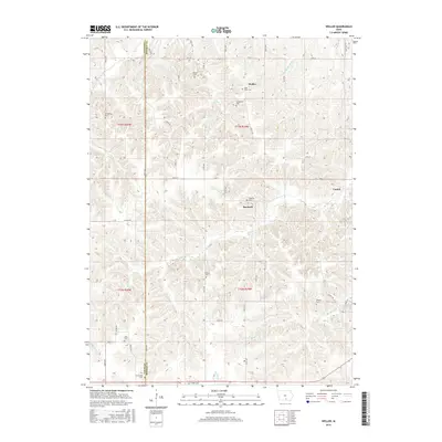
2015 Map of Weller
USGS Topo · Published 2015About this map
Weller and Bucknell sit within the dissected uplands of the Lucas and Monroe County line, a landscape defined by the intricate drainage of Whippoorwill Creek and Sage Creek. This Iowa landscape is notably dense with small family and community burial grounds, serving as a vital record for genealogists. From the Saint Marys Cem near Weller to the Peterson Cem and Stoneking Cem, these sites are scattered across the township lines of t73n r19w and t73n r20w. The settlement of Consol appears on the eastern edge, while the south is marked by Conrey Creek and the Prather Cem. The terrain is characterized by steep ravines and narrow ridges, which dictated the winding paths of rural routes like County Road H20 and 527th Avenue.
Find a feature on this map
53 named features on this map. Tap any name to fly to it.
Don’t see what you’re looking for? This feature index may not catch every label — zoom into the map to look around manually.
Map Details
Editions of this 2015 Weller Map
This is the sole edition of this map. No revisions or reprints were ever made.
Other maps of this area

1924 · Melcher
USGS Topo · 1:62,500

1929 · Albia
USGS Topo · 1:62,500

1935 · Russell
USGS Topo · 1:62,500

1938 · Russell
USGS Topo · 1:62,500

1939 · Mystic
USGS Topo · 1:62,500

1942 · Mystic
USGS Topo · 1:62,500

1954 · Centerville
USGS Topo · 1:250,000

1954 · Des Moines
USGS Topo · 1:250,000

1956 · Des Moines
USGS Topo · 1:250,000

1957 · Des Moines
USGS Topo · 1:250,000