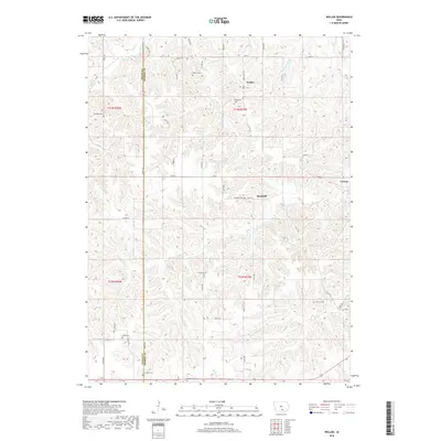
2018 Map of Weller
USGS Topo · Published 2018About this map
The boundary between Lucas Co and Monroe Co bisects a landscape defined by deeply carved creek valleys and a high density of rural burial grounds. Small communities like Weller and Bucknell are interspersed among a network of family and community landmarks, including Saint Marys Cem, O'Brien Cem, and Stoneking Cem. This terrain is drained by several meandering waterways such as North Cedar Creek, Sage Cr, and Whites Cr, which have shaped the local topography into a series of ridges and draws. These physical features historically dictated the placement of pioneer roads like Co RD h20 and Co RD h32. The presence of numerous smaller cemeteries like Foutch Cem and Manley Cem suggests a long-settled rural population that utilized the high ground between the various branches of Whippoorwill Cr for both homesteads and memorial sites.
Find a feature on this map
33 named features on this map. Tap any name to fly to it.
Don’t see what you’re looking for? This feature index may not catch every label — zoom into the map to look around manually.
Map Details
Editions of this 2018 Weller Map
This is the sole edition of this map. No revisions or reprints were ever made.
Other maps of this area

1924 · Melcher
USGS Topo · 1:62,500

1929 · Albia
USGS Topo · 1:62,500

1935 · Russell
USGS Topo · 1:62,500

1938 · Russell
USGS Topo · 1:62,500

1939 · Mystic
USGS Topo · 1:62,500

1942 · Mystic
USGS Topo · 1:62,500

1954 · Centerville
USGS Topo · 1:250,000

1954 · Des Moines
USGS Topo · 1:250,000

1956 · Des Moines
USGS Topo · 1:250,000

1957 · Des Moines
USGS Topo · 1:250,000