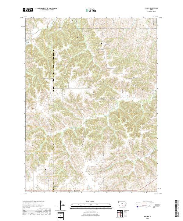
2022 Map of Weller
USGS Topo · Published 2022About this map
The rolling hills along the Lucas Co Monroe Co boundary are defined by a network of creeks and small settlements in this 2022 survey. Weller and Bucknell serve as focal points for the rural road network, which includes Co Rd H20 and Co Rd H32. The landscape is notably dense with family and community burial grounds, reflecting a long history of local settlement. Numerous sites such as Saint Marys Cem, O'Brien Cem, and Smithfield Cem are scattered across the terrain near the headwaters of Whippoorwill Cr and Whites Cr. Further south, the map captures the transition into more dissected valley systems around Coal Creek and Sage Cr, where the LaGrange Cem and Prather Cem mark the heritage of these interior Iowa townships.
Find a feature on this map
34 named features on this map. Tap any name to fly to it.
Don’t see what you’re looking for? This feature index may not catch every label — zoom into the map to look around manually.
Map Details
Editions of this 2022 Weller Map
This is the sole edition of this map. No revisions or reprints were ever made.
Other maps of this area

1924 · Melcher
USGS Topo · 1:62,500

1929 · Albia
USGS Topo · 1:62,500

1935 · Russell
USGS Topo · 1:62,500

1938 · Russell
USGS Topo · 1:62,500

1939 · Mystic
USGS Topo · 1:62,500

1942 · Mystic
USGS Topo · 1:62,500

1954 · Centerville
USGS Topo · 1:250,000

1954 · Des Moines
USGS Topo · 1:250,000

1956 · Des Moines
USGS Topo · 1:250,000

1957 · Des Moines
USGS Topo · 1:250,000