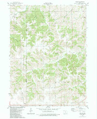
1982 Map of Weller
USGS Topo · Published 1983About this map
Stephens State Forest dominates the northwestern reaches of this Iowa landscape, where the deeply dissected terrain of the Lucas and Monroe County line meets the headwaters of several drainages. The small community of Weller is centered near St Marys Ch, while the surrounding countryside is marked by a high density of rural burial grounds, including Stoneking Cem, Smithfield Cem, and Manley Cem.
Find a feature on this map
22 named features on this map. Tap any name to fly to it.
Don’t see what you’re looking for? This feature index may not catch every label — zoom into the map to look around manually.
Map Details
Editions of this 1982 Weller Map
This is the sole edition of this map. No revisions or reprints were ever made.
Other maps of this area

1924 · Melcher
USGS Topo · 1:62,500

1929 · Albia
USGS Topo · 1:62,500

1935 · Russell
USGS Topo · 1:62,500

1938 · Russell
USGS Topo · 1:62,500

1939 · Mystic
USGS Topo · 1:62,500

1942 · Mystic
USGS Topo · 1:62,500

1954 · Centerville
USGS Topo · 1:250,000

1954 · Des Moines
USGS Topo · 1:250,000

1956 · Des Moines
USGS Topo · 1:250,000

1957 · Des Moines
USGS Topo · 1:250,000