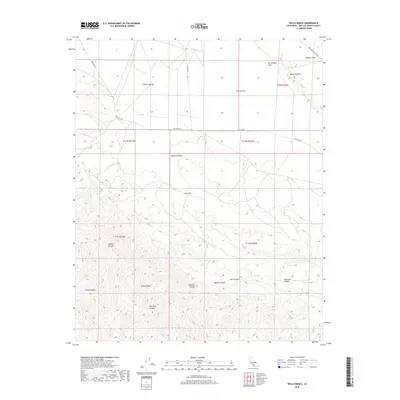
2018 Map of Wells Ranch
USGS Topo · Published 2018About this map
The San Andreas Fault bisects this portion of San Luis Obispo County, creating the distinctive tectonic topography of the Elkhorn Scarp that separates the Elkhorn Plain from the Carrizo Plain. This arid, high-desert environment is defined by its dramatic geological features and scarce water sources, such as Semper Spring and Wells Spring, which were vital for the establishment of Wells Ranch. To the south, the terrain rises sharply into the Caliente Range, a complex landscape of ridges and deep drainages including Abbott Canyon, Horse Canyon, and Wells Canyon. The road network is sparse, centered on the primary thoroughfare of Soda Lake Rd, reflecting a landscape dominated by large-scale ranching and tectonic activity rather than dense settlement.
Find a feature on this map
25 named features on this map. Tap any name to fly to it.
Don’t see what you’re looking for? This feature index may not catch every label — zoom into the map to look around manually.
Map Details
Editions of this 2018 Wells Ranch Map
This is the sole edition of this map. No revisions or reprints were ever made.
Other maps of this area

1902 · Santa Ynez
USGS Topo · 1:125,000

1905 · Santa Ynez
USGS Topo · 1:125,000

1912 · McKittrick
USGS Topo · 1:125,000

1941 · Caliente Mountain
USGS Topo · 1:62,500

1941 · McPherson Peak
USGS Topo · 1:62,500

1942 · Caliente Mtn
USGS Topo · 1:62,500

1942 · East of Cuyama Ranch
USGS Topo · 1:24,000

1943 · McPherson Peak
USGS Topo · 1:62,500

1943 · Caliente Mtn.
USGS Topo · 1:62,500

1943 · Cuyama Ranch
USGS Topo · 1:31,680