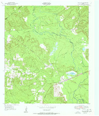
1951 Map of Wells SW
USGS Topo · Published 1951About this map
The Neches River meanders through this heavily forested landscape along the borders of Trinity, Angelina, and Houston counties during the early 1950s. The area is defined by its deep connection to the timber industry, evidenced by the extensive Logging Railroad network and remnants of an Old Grade cutting through the Davy Crockett National Forest. Small settlements and transit points like Vair and Raville Siding provided essential hubs for local operations and rail transport.
Find a feature on this map
39 named features on this map. Tap any name to fly to it.
Don’t see what you’re looking for? This feature index may not catch every label — zoom into the map to look around manually.
Map Details
Editions of this 1951 Wells SW Map
Other maps of this area

1949 · Clawson
USGS Topo · 1:24,000

1949 · Keltys
USGS Topo · 1:24,000

1950 · Keltys
USGS Topo · 1:24,000

1950 · Clawson
USGS Topo · 1:24,000

1950 · Kennard NE
USGS Topo · 1:24,000

1950 · Centralia
USGS Topo · 1:24,000

1951 · Wells
USGS Topo · 1:24,000

1951 · Wells SW
USGS Topo · 1:24,000

1951 · Centralia
USGS Topo · 1:24,000

1951 · Kennard NE
USGS Topo · 1:24,000