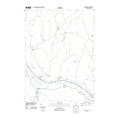
2010 Map of Wellsburg
USGS Topo · Published 2010About this map
The Chemung River valley defines this region south of Elmira, where the village of Wellsburg serves as a key settlement near the Pennsylvania border. The river's path is flanked by landforms such as Baldwin Island and the rising elevations of Shoemaker Mountain and Narrow Hill. The landscape is a mix of clustered residential areas like Holly Park Terrace and agricultural spaces such as Millards Berry Farm and Foxwin Farm.
Find a feature on this map
96 named features on this map. Tap any name to fly to it.
Don’t see what you’re looking for? This feature index may not catch every label — zoom into the map to look around manually.
Map Details
Editions of this 2010 Wellsburg Map
This is the sole edition of this map. No revisions or reprints were ever made.
Other maps of this area

1895 · Elmira
USGS Topo · 1:62,500

1902 · Waverly
USGS Topo · 1:62,500

1905 · Watkins Glen
USGS Topo · 1:125,000

1931 · Troy
USGS Topo · 1:48,000

1938 · Troy
USGS Topo · 1:62,500

1939 · Sayre
USGS Topo · 1:62,500

1942 · Sayre
USGS Topo · 1:62,500

1948 · Sayre
USGS Topo · 1:62,500

1950 · Elmira
USGS Topo · 1:250,000
1953 · Horseheads
USGS Topo · 1:24,000