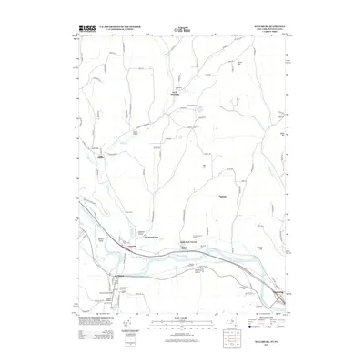
2013 Map of Wellsburg
USGS Topo · Published 2013About this map
The Chemung River carves a broad valley through the southern tier of New York on this 2013 survey, anchoring the village of Wellsburg and the hamlet of Lowman. The landscape is a mix of river-bottom agriculture and steep ridges, where small family-named landmarks like Brown Hill and Oak Hill rise above the drainage of Baldwin Cr. Genealogists will find several small burial grounds across the hills, including Ashland Cem and the Elliott Searles Cem near the river, while the Wellsburg Baptist Church serves as a central landmark for the village. North of the river, the settlement pattern shifts toward residential pockets like Holly Park Terrace and Birchland Park, while North Chemung remains a distinct rural center. The mapping reflects a modern era of land management, featuring the Chemung County Landfill alongside recreational sites like the Garner Hill Campground.
Find a feature on this map
104 named features on this map. Tap any name to fly to it.
Don’t see what you’re looking for? This feature index may not catch every label — zoom into the map to look around manually.
Map Details
Editions of this 2013 Wellsburg Map
This is the sole edition of this map. No revisions or reprints were ever made.
Other maps of this area

1895 · Elmira
USGS Topo · 1:62,500

1902 · Waverly
USGS Topo · 1:62,500

1905 · Watkins Glen
USGS Topo · 1:125,000

1931 · Troy
USGS Topo · 1:48,000

1938 · Troy
USGS Topo · 1:62,500

1939 · Sayre
USGS Topo · 1:62,500

1942 · Sayre
USGS Topo · 1:62,500

1948 · Sayre
USGS Topo · 1:62,500

1950 · Elmira
USGS Topo · 1:250,000
1953 · Horseheads
USGS Topo · 1:24,000