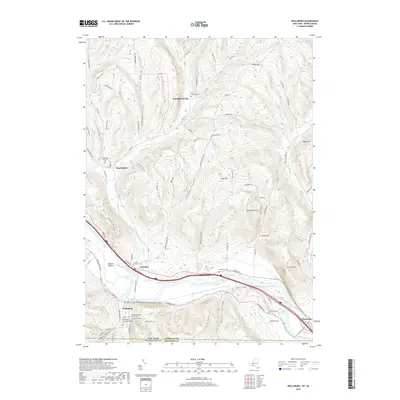
2019 Map of Wellsburg
USGS Topo · Published 2019About this map
The Chemung River carves a significant path across this landscape, defining the valley floor where the settlements of Lowman, Wellsburg, and Chemung are situated. This river corridor has long served as a vital artery for transportation and settlement, mirrored by the modern path of Oneida Rd and various local thoroughfares like Wilawanna Rd. The map reveals a high density of burial grounds, such as Elliott-Searles Cem and Dutchtown Cem, which are invaluable for genealogical research in this part of Chemung County.
Find a feature on this map
89 named features on this map. Tap any name to fly to it.
Don’t see what you’re looking for? This feature index may not catch every label — zoom into the map to look around manually.
Map Details
Editions of this 2019 Wellsburg Map
This is the sole edition of this map. No revisions or reprints were ever made.
Other maps of this area

1895 · Elmira
USGS Topo · 1:62,500

1902 · Waverly
USGS Topo · 1:62,500

1905 · Watkins Glen
USGS Topo · 1:125,000

1931 · Troy
USGS Topo · 1:48,000

1938 · Troy
USGS Topo · 1:62,500

1939 · Sayre
USGS Topo · 1:62,500

1942 · Sayre
USGS Topo · 1:62,500

1948 · Sayre
USGS Topo · 1:62,500

1950 · Elmira
USGS Topo · 1:250,000
1953 · Horseheads
USGS Topo · 1:24,000