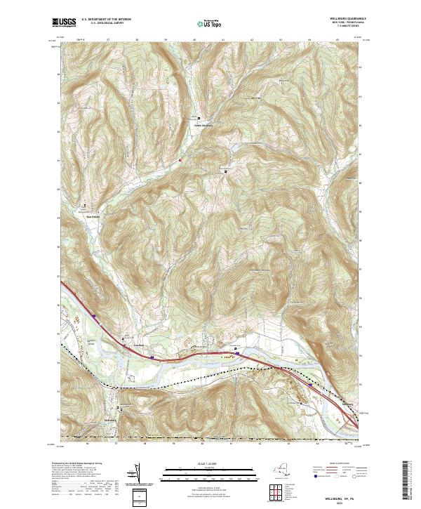
2023 Map of Wellsburg
USGS Topo · Published 2023About this map
The Chemung River carves a deep valley through the southern tier of New York, defining the settlement patterns of Wellsburg and Lowman. This river corridor serves as a primary transit route, flanked by the broad Chemung Flats and the prominent Baldwin Island. The surrounding landscape is characterized by steep ridges and narrow hollows, such as Elston Hollow and Hoffman Hollow, where small-scale agriculture and rural dwellings follow the winding paths of Baldwin Creek and Goldsmith Creek. Local history is preserved in a network of family and community burial grounds, including the Wacomber Cem and Dutchtown Cem, alongside landmarks like the Wellsburg Baptist Church. The map also captures the New York Pennsylvania state line, illustrating how the topography of Shoemaker Mountain and Narrow Hill ignores political boundaries.
Find a feature on this map
88 named features on this map. Tap any name to fly to it.
Don’t see what you’re looking for? This feature index may not catch every label — zoom into the map to look around manually.
Map Details
Editions of this 2023 Wellsburg Map
This is the sole edition of this map. No revisions or reprints were ever made.
Other maps of this area

1895 · Elmira
USGS Topo · 1:62,500

1902 · Waverly
USGS Topo · 1:62,500

1905 · Watkins Glen
USGS Topo · 1:125,000

1931 · Troy
USGS Topo · 1:48,000

1938 · Troy
USGS Topo · 1:62,500

1939 · Sayre
USGS Topo · 1:62,500

1942 · Sayre
USGS Topo · 1:62,500

1948 · Sayre
USGS Topo · 1:62,500

1950 · Elmira
USGS Topo · 1:250,000
1953 · Horseheads
USGS Topo · 1:24,000