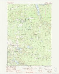
1987 Map of Wellston
USGS Topo · Published 1988About this map
Wellston sits at the northern edge of this landscape, surrounded by the dense woodlands of the Manistee National Forest. The geography is defined by a network of glacial lakes and rivers, including the winding Pine River and the expansive Tippy Dam Pond. Traces of the region's historical infrastructure are visible through several stretches of Old Railroad Grade and the Old Indian Treaty Boundary, which cuts diagonally across the forest. These features highlight the transition from early industrial logging and indigenous lands to a protected wilderness. Further south, the small settlements of Dublin and Irons provide anchors within the timberland, while a solitary Landing Strip and scattered sites like Water Tank Lake and Sucker Pond speak to the specialized land use within the Manistee River watershed during the late 1980s.
Find a feature on this map
42 named features on this map. Tap any name to fly to it.
Don’t see what you’re looking for? This feature index may not catch every label — zoom into the map to look around manually.
Map Details
Editions of this 1987 Wellston Map
2 editions found
Other maps of this area

1932 · Freesoil SE
USGS Topo · 1:31,680

1933 · Peacock SE
USGS Topo · 1:31,680

1933 · Peacock SW
USGS Topo · 1:31,680

1933 · Peacock NE
USGS Topo · 1:31,680

1933 · Peacock NW
USGS Topo · 1:31,680

1954 · Traverse City
USGS Topo · 1:250,000

1954 · Manitowoc
USGS Topo · 1:250,000

1956 · Onekama
USGS Topo · 1:62,500

1957 · Freesoil
USGS Topo · 1:62,500

1957 · Copemish
USGS Topo · 1:62,500