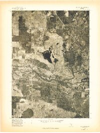
1976 Map of Wellston SE
USGS Topo · Published 1976About this map
The Little Manistee River winds through this 1976 orthophotoquad, which captures the dense woodland and wetland textures of northern Michigan during the mid-1970s. This specific image was produced as an advance print from an aerial photograph taken on May 8, 1976, offering a high-contrast look at the seasonal vegetation and water levels just as the region entered its spring growth. The map's photographic nature provides an unfiltered view of the terrain, revealing the intricate drainage patterns and small kettle lakes characteristic of this glaciated landscape. Because the quadrangle is largely undeveloped, the visibility of the river corridor and the clearings in the timber stand as the primary indicators of the land's transition and use at the time of the survey.
Find a feature on this map
1 named feature on this map. Tap any name to fly to it.
Don’t see what you’re looking for? This feature index may not catch every label — zoom into the map to look around manually.
Map Details
Editions of this 1976 Wellston SE Map
This is the sole edition of this map. No revisions or reprints were ever made.
Other maps of this area

1931 · Baldwin NW
USGS Topo · 1:31,680

1931 · Baldwin NE
USGS Topo · 1:31,680

1932 · Chase NW
USGS Topo · 1:31,680

1933 · Peacock SE
USGS Topo · 1:31,680

1933 · Peacock SW
USGS Topo · 1:31,680

1933 · Peacock NE
USGS Topo · 1:31,680

1933 · Luther SW
USGS Topo · 1:31,680

1933 · Luther NW
USGS Topo · 1:31,680

1933 · Peacock NW
USGS Topo · 1:31,680

1954 · Traverse City
USGS Topo · 1:250,000