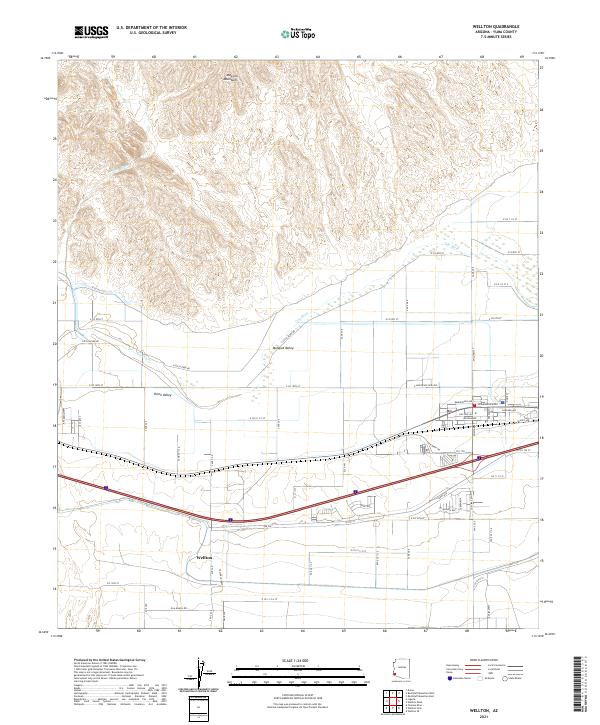
2021 Map of Wellton
USGS Topo · Published 2021About this map
The Gila River winds through the northern portion of this quadrangle, defining the low-lying agricultural corridors of Mohawk Valley and Dome Valley. North of the river, the terrain rises sharply into the jagged contours of the Muggins Mountains, where the intermittent Morgan Wash carves through the arid landscape. This 2021 survey illustrates the modern grid of Wellton, emphasizing its role as a transit and irrigation hub for the surrounding desert. The settlement pattern is largely dictated by the river's path, with a dense network of local roads such as S Gila Levee Rd and N Gila Levee Rd supporting the agricultural operations that thrive in these fertile valley floors. The transition from the rugged mountains to the engineered irrigation landscape of Wellton highlights the intersection of natural topography and human enterprise in Yuma County.
Find a feature on this map
59 named features on this map. Tap any name to fly to it.
Don’t see what you’re looking for? This feature index may not catch every label — zoom into the map to look around manually.
Map Details
Editions of this 2021 Wellton Map
This is the sole edition of this map. No revisions or reprints were ever made.
Other maps of this area

1926 · Fortuna
USGS Topo · 1:62,500

1926 · Wellton
USGS Topo · 1:62,500

1929 · Fortuna
USGS Topo · 1:62,500

1929 · Laguna
USGS Topo · 1:62,500

1929 · Wellton
USGS Topo · 1:62,500

1942 · Yuma
USGS Topo · 1:250,000

1943 · Laguna
USGS Topo · 1:62,500

1954 · El Centro
USGS Topo · 1:250,000

1955 · El Centro
USGS Topo · 1:250,000
1955 · Dome
USGS Topo · 1:24,000