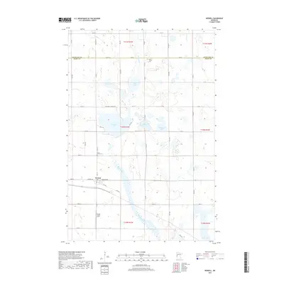
2019 Map of Wendell
USGS Topo · Published 2019About this map
The Mustinka River meanders diagonally through this section of the Minnesota prairie, providing a natural break in the highly regular township-and-range grid. The village of Wendell serves as the primary hub for the surrounding agricultural community, situated near several significant glacial water bodies. To the north and west, the landscape is dotted with numerous basins, including Lightning Lake, Pletan Lake, and Stony Brook Lake, which reflect the area's geological history. For those tracing local heritage, the map identifies significant sites such as the Rock Prairie Cem and Trinity Lutheran Cem, both situated along the rural gravel roads that partition the farmland. The presence of Brutlag Farms Airport south of town indicates the ongoing intersection of modern infrastructure with the region's deep agricultural roots along the border of Otter Tail and Grant Counties.
Find a feature on this map
30 named features on this map. Tap any name to fly to it.
Don’t see what you’re looking for? This feature index may not catch every label — zoom into the map to look around manually.
Map Details
Editions of this 2019 Wendell Map
This is the sole edition of this map. No revisions or reprints were ever made.
Other maps of this area

1910 · Wendell
USGS Topo · 1:62,500

1911 · Barrett
USGS Topo · 1:62,500

1911 · Herman
USGS Topo · 1:62,500

1913 · Ashby
USGS Topo · 1:62,500

1913 · Wendell
USGS Topo · 1:62,500

1953 · Milbank
USGS Topo · 1:250,000

1953 · Fargo
USGS Topo · 1:250,000

1953 · Brainerd
USGS Topo · 1:250,000

1953 · Saint Cloud
USGS Topo · 1:250,000

1956 · Fargo
USGS Topo · 1:250,000