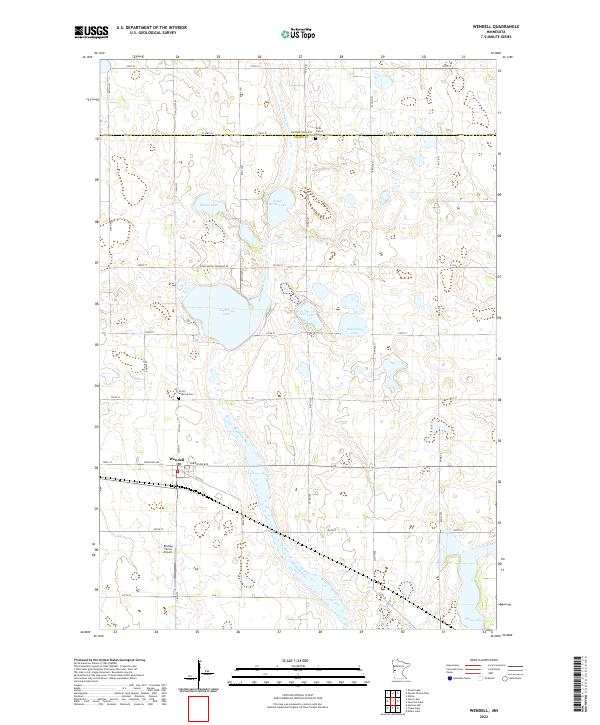
2022 Map of Wendell
USGS Topo · Published 2022About this map
The Mustinka River winds through this agricultural landscape on the border of Otter Tail Co and Grant Co. This region of western Minnesota is defined by its glacial lakes and steady settlement patterns, anchored by the town of Wendell. The township grid system is well-established, with roads like Stony Brook Township Rd and Co Hwy 11 providing access to the fertile lands between numerous water bodies including Pletan Lake, Lightning Lake, and Stony Brook Lake. Local history and genealogy interest is concentrated at the Rock Prairie Cem and Trinity Lutheran Cem, both situated along rural routes. The presence of the Brutlag Farms Airport south of town indicates the integration of aviation into the modern farming operations of this prairie district.
Find a feature on this map
54 named features on this map. Tap any name to fly to it.
Don’t see what you’re looking for? This feature index may not catch every label — zoom into the map to look around manually.
Map Details
Editions of this 2022 Wendell Map
This is the sole edition of this map. No revisions or reprints were ever made.
Other maps of this area

1910 · Wendell
USGS Topo · 1:62,500

1911 · Barrett
USGS Topo · 1:62,500

1911 · Herman
USGS Topo · 1:62,500

1913 · Ashby
USGS Topo · 1:62,500

1913 · Wendell
USGS Topo · 1:62,500

1953 · Milbank
USGS Topo · 1:250,000

1953 · Fargo
USGS Topo · 1:250,000

1953 · Brainerd
USGS Topo · 1:250,000

1953 · Saint Cloud
USGS Topo · 1:250,000

1956 · Fargo
USGS Topo · 1:250,000