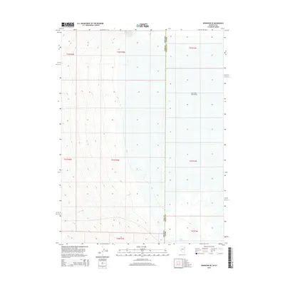
2014 Map of Wendover SE
USGS Topo · Published 2014About this map
Great Salt Lake Desert dominates the eastern expanse of this map, representing the stark, flat geography along the border of Utah and Nevada. The state line divides the landscape between Elko County and Tooele County, cutting through a region defined by its wide, open alkaline flats and subtle drainage patterns. Felt Wash meanders through the western terrain, providing a rare topographical variation in an otherwise uniform basin. In the southern reach of the quadrangle, Blue Lake appears as a distinct hydrological feature, offering a sharp contrast to the surrounding desert environment. This area serves as a significant geographical study of the Great Basin's interior, where the transition from desert floor to the occasional spring-fed lake defines the local ecosystem.
Find a feature on this map
12 named features on this map. Tap any name to fly to it.
Don’t see what you’re looking for? This feature index may not catch every label — zoom into the map to look around manually.
Map Details
Editions of this 2014 Wendover SE Map
This is the sole edition of this map. No revisions or reprints were ever made.
Other maps of this area

1953 · Tooele
USGS Topo · 1:250,000

1955 · Tooele
USGS Topo · 1:250,000

1955 · Elko
USGS Topo · 1:250,000

1958 · Elko
USGS Topo · 1:250,000

1962 · Elko
USGS Topo · 1:250,000

1965 · Elko
USGS Topo · 1:250,000

1972 · Ferguson Flat
USGS Topo · 1:24,000

1972 · Ferguson Mtn.
USGS Topo · 1:24,000

1972 · Ola
USGS Topo · 1:24,000
1972 · Spring Gulch
USGS Topo · 1:24,000