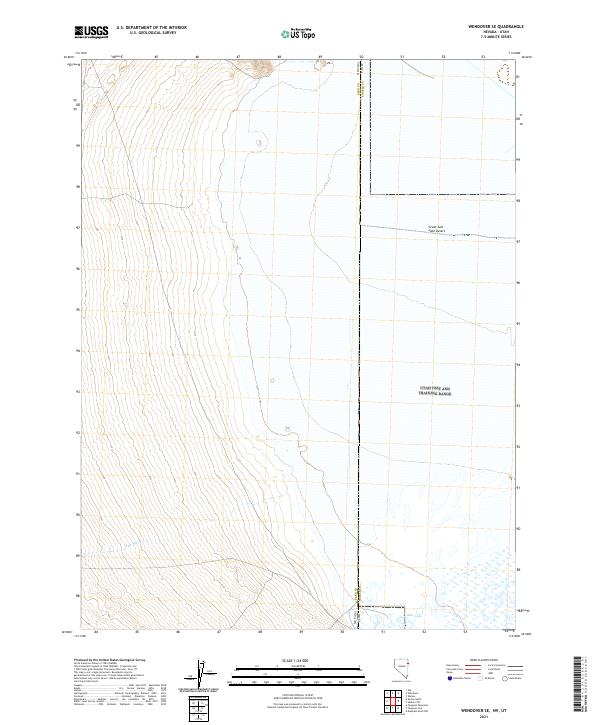
2021 Map of Wendover SE
USGS Topo · Published 2021About this map
Great Salt Lake Desert dominates the eastern landscape of this 2021 topographic survey, where the arid basin crosses from Nevada into Utah. The vast salt flats transition into the alluvial fans of Elko and Tooele counties, revealing the drainage patterns of ephemeral watercourses like Felt Wash. In the southeast corner, the presence of Blue Lake provides a striking contrast to the surrounding desert, marking a permanent water feature in a region defined by its extreme aridity and stark, shifting terrain. This map captures the modern boundary and hydrographic state of the Bonneville Salt Flats periphery before contemporary climate shifts and land use further alter these delicate desert systems.
Find a feature on this map
5 named features on this map. Tap any name to fly to it.
Don’t see what you’re looking for? This feature index may not catch every label — zoom into the map to look around manually.
Map Details
Editions of this 2021 Wendover SE Map
This is the sole edition of this map. No revisions or reprints were ever made.
Other maps of this area

1953 · Tooele
USGS Topo · 1:250,000

1955 · Tooele
USGS Topo · 1:250,000

1955 · Elko
USGS Topo · 1:250,000

1958 · Elko
USGS Topo · 1:250,000

1962 · Elko
USGS Topo · 1:250,000

1965 · Elko
USGS Topo · 1:250,000

1972 · Ferguson Flat
USGS Topo · 1:24,000

1972 · Ferguson Mtn.
USGS Topo · 1:24,000

1972 · Ola
USGS Topo · 1:24,000
1972 · Spring Gulch
USGS Topo · 1:24,000