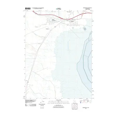
2011 Map of Wendover
USGS Topo · Published 2011About this map
West Wendover and Wendover straddle the state line in this early 21st-century mapping of the high desert borderlands. The landscape is defined by the stark transition from the Lippy Hills, featuring landmarks like Window Rock and Needle Point, down toward the expansive flatlands. Aviation history and modern transport are prominent, with the extensive grounds of the Wendover Airport complemented by smaller facilities like the Bush Leland Landing Strip and Dover Field. The map records the local infrastructure of the era, from the residential grids of Eastline to the established Wendover Cemetery. Farther south, the isolated settlement of Ninemile sits along the roadway, illustrating the sparse but vital transport nodes required to navigate this portion of the Great Basin.
Find a feature on this map
14 named features on this map. Tap any name to fly to it.
Don’t see what you’re looking for? This feature index may not catch every label — zoom into the map to look around manually.
Map Details
Editions of this 2011 Wendover Map
This is the sole edition of this map. No revisions or reprints were ever made.
Other maps of this area

1953 · Tooele
USGS Topo · 1:250,000

1955 · Tooele
USGS Topo · 1:250,000

1955 · Elko
USGS Topo · 1:250,000

1958 · Elko
USGS Topo · 1:250,000

1962 · Elko
USGS Topo · 1:250,000

1965 · Elko
USGS Topo · 1:250,000

1971 · Pilot
USGS Topo · 1:24,000

1971 · Leppy Peak
USGS Topo · 1:24,000

1971 · Tetzlaff Peak
USGS Topo · 1:24,000

1972 · Ola
USGS Topo · 1:24,000