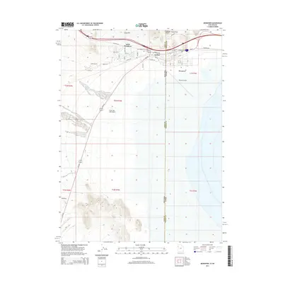
2014 Map of Wendover
USGS Topo · Published 2014About this map
West Wendover, Nevada and Wendover, Utah straddle the state line at the edge of the Great Salt Lake Desert in this 2014 survey. The map details the urban and industrial layout of these border towns, showing the proximity of the Wendover Airport to the core settlement area. The geographic transition from the high relief of the Leppy Hills and Needle Point Rock down to the vast, flat expanse of the salt desert is clearly defined. Transportation infrastructure is a central theme, with Wendover Blvd and Frontage Rd providing access across the state boundary, while local landmarks like the Wendover Cem and the settlement at Eastline offer points of interest for those researching the local genealogy and municipal growth of this high-desert region.
Find a feature on this map
23 named features on this map. Tap any name to fly to it.
Don’t see what you’re looking for? This feature index may not catch every label — zoom into the map to look around manually.
Map Details
Editions of this 2014 Wendover Map
This is the sole edition of this map. No revisions or reprints were ever made.
Other maps of this area

1953 · Tooele
USGS Topo · 1:250,000

1955 · Tooele
USGS Topo · 1:250,000

1955 · Elko
USGS Topo · 1:250,000

1958 · Elko
USGS Topo · 1:250,000

1962 · Elko
USGS Topo · 1:250,000

1965 · Elko
USGS Topo · 1:250,000

1971 · Pilot
USGS Topo · 1:24,000

1971 · Leppy Peak
USGS Topo · 1:24,000

1971 · Tetzlaff Peak
USGS Topo · 1:24,000

1972 · Ola
USGS Topo · 1:24,000