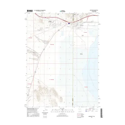
2017 Map of Wendover
USGS Topo · Published 2017About this map
West Wendover, Nevada, and its eastern neighbor Wendover, Utah, straddle the state line at the western edge of the Great Salt Lake Desert. This landscape is defined by the sharp contrast between the alkali flats to the east and the rising terrain of the Leppy Hills and Ninemile to the west. The border community is centered around major thoroughfares like Wendover Blvd, with the Wendover Airport serving as a significant landmark on the Utah side. Local history and genealogy interest is anchored by the Wendover Cem and prominent natural features such as Window Rock and Needle Point. The grid-like street layout of Moriah Ave and Pequop Ave shows the concentrated development that supports the local economy along this interstate corridor.
Find a feature on this map
32 named features on this map. Tap any name to fly to it.
Don’t see what you’re looking for? This feature index may not catch every label — zoom into the map to look around manually.
Map Details
Editions of this 2017 Wendover Map
This is the sole edition of this map. No revisions or reprints were ever made.
Other maps of this area

1953 · Tooele
USGS Topo · 1:250,000

1955 · Tooele
USGS Topo · 1:250,000

1955 · Elko
USGS Topo · 1:250,000

1958 · Elko
USGS Topo · 1:250,000

1962 · Elko
USGS Topo · 1:250,000

1965 · Elko
USGS Topo · 1:250,000

1971 · Pilot
USGS Topo · 1:24,000

1971 · Leppy Peak
USGS Topo · 1:24,000

1971 · Tetzlaff Peak
USGS Topo · 1:24,000

1972 · Ola
USGS Topo · 1:24,000