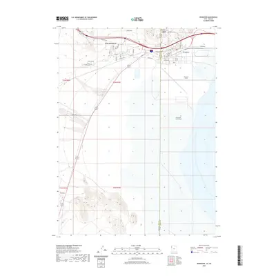
2020 Map of Wendover
USGS Topo · Published 2020About this map
West Wendover, Nevada, and its twin city Wendover, Utah, sit at the threshold of the Great Salt Lake Desert in this modern topographic record. The state line divides these two high-desert communities, with the Nevada side displaying a more dense network of residential streets such as Fairway View Dr and Florence Way. To the east, the terrain levels out significantly into the salt flats, where the Wendover Airport and the Wendover Cem occupy the transition between the urban corridor and the desert. To the north, the topography rises sharply into the Leppy Hills, featuring distinct landmarks like Window Rock and Needle Point. The presence of the Ninemile marker south of the city suggests the long-standing importance of this route as a gateway across the flats, even as modern infrastructure like Wendover Blvd facilitates travel through the basin today.
Find a feature on this map
28 named features on this map. Tap any name to fly to it.
Don’t see what you’re looking for? This feature index may not catch every label — zoom into the map to look around manually.
Map Details
Editions of this 2020 Wendover Map
This is the sole edition of this map. No revisions or reprints were ever made.
Other maps of this area

1953 · Tooele
USGS Topo · 1:250,000

1955 · Tooele
USGS Topo · 1:250,000

1955 · Elko
USGS Topo · 1:250,000

1958 · Elko
USGS Topo · 1:250,000

1962 · Elko
USGS Topo · 1:250,000

1965 · Elko
USGS Topo · 1:250,000

1971 · Pilot
USGS Topo · 1:24,000

1971 · Leppy Peak
USGS Topo · 1:24,000

1971 · Tetzlaff Peak
USGS Topo · 1:24,000

1972 · Ola
USGS Topo · 1:24,000