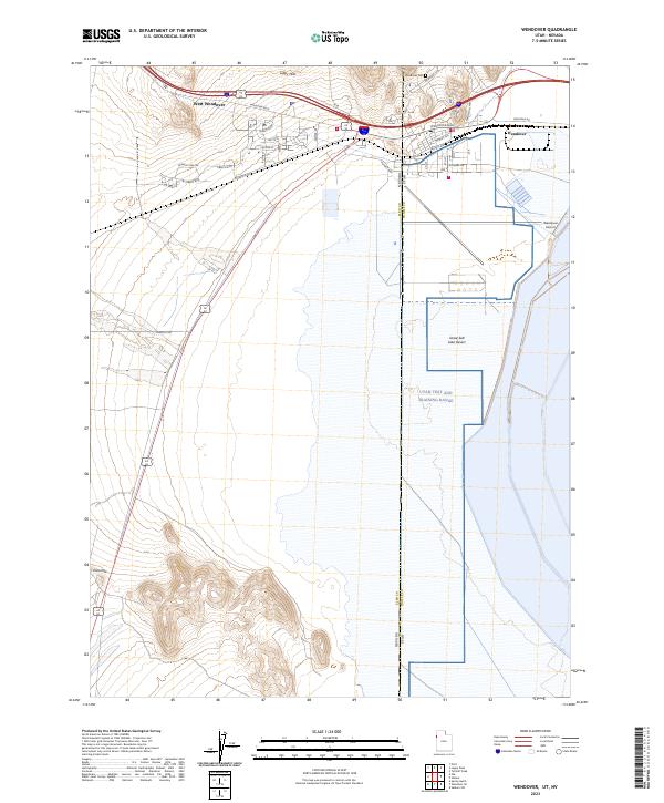
2023 Map of Wendover
USGS Topo · Published 2023About this map
West Wendover and Wendover sit at the intersection of high desert topography and the vast expanse of the Great Salt Lake Desert. This 2023 survey illustrates the modern layout of these twin border towns, where the Nevada-Utah state line bisects the urban corridor. To the north, the Leppy Hills provide a stark vertical contrast to the salt flats that dominate the lower half of the sheet. The region's history as a military and aviation hub is evident through the expansive Wendover Airport and the neighboring Utah Test and Training Range. Residential development is shown through a network of streets like Pueblo Blvd and Moriah Ave, while the Wendover Cem and the location at Ninemile offer specific points of interest for genealogists and local historians tracing the evolution of this remote desert outpost.
Find a feature on this map
34 named features on this map. Tap any name to fly to it.
Don’t see what you’re looking for? This feature index may not catch every label — zoom into the map to look around manually.
Map Details
Editions of this 2023 Wendover Map
This is the sole edition of this map. No revisions or reprints were ever made.
Other maps of this area

1953 · Tooele
USGS Topo · 1:250,000

1955 · Tooele
USGS Topo · 1:250,000

1955 · Elko
USGS Topo · 1:250,000

1958 · Elko
USGS Topo · 1:250,000

1962 · Elko
USGS Topo · 1:250,000

1965 · Elko
USGS Topo · 1:250,000

1971 · Pilot
USGS Topo · 1:24,000

1971 · Leppy Peak
USGS Topo · 1:24,000

1971 · Tetzlaff Peak
USGS Topo · 1:24,000

1972 · Ola
USGS Topo · 1:24,000