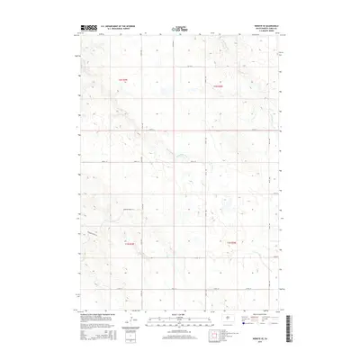
2015 Map of Wendte SE
USGS Topo · Published 2015About this map
Herd Camp Creek and its smaller tributaries wind through this section of Jones County, carving subtle drainages across the landscape of south-central South Dakota. This 2015 data reflects the vast ranching and agricultural character of the region, where the Public Land Survey System grid is clearly marked by townships such as t2n r29e and t2n r30e. Named features like Hermann Ranch Pl indicate the localized nature of the road network, which primarily consists of a geometric grid of section lines including 277th Ave and 229th St. In the northern portion of the map, the headwaters of W Br War Cr emerge, further defining the local topography. This document provides a record of land divisions and rural infrastructure, documenting the sparse but persistent human footprint on the prairie.
Find a feature on this map
18 named features on this map. Tap any name to fly to it.
Don’t see what you’re looking for? This feature index may not catch every label — zoom into the map to look around manually.
Map Details
Editions of this 2015 Wendte SE Map
This is the sole edition of this map. No revisions or reprints were ever made.
Other maps of this area

1953 · Wendte
USGS Topo · 1:24,000

1953 · Wendte NE
USGS Topo · 1:24,000

1953 · Pierre 3 NW
USGS Topo · 1:24,000

1954 · Pierre
USGS Topo · 1:250,000

1955 · Martin
USGS Topo · 1:250,000

1958 · Pierre
USGS Topo · 1:250,000

1958 · Martin
USGS Topo · 1:250,000

1972 · Pierre 3 SW
USGS Topo · 1:24,000

1972 · Draper
USGS Topo · 1:24,000

1972 · Murdo
USGS Topo · 1:24,000