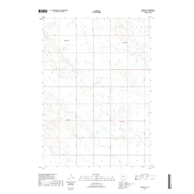
2017 Map of Wendte SE
USGS Topo · Published 2017About this map
Herd Camp Creek defines the drainage of this Jones County landscape, meandering through a series of section lines that mark the rural geography of South Dakota. The land is organized by a strict grid of gravel and section roads, including Lincoln Rd and Cemetery Rd, which connect remote farmsteads and agricultural parcels. In the northeast corner, the headwaters of W Br War Cr begin their descent, cutting through the high plains. The topography is characterized by subtle elevation changes and numerous small depressions and wetlands common to this region of the Great Plains. This 2017 survey reflects a sparsely populated area where the infrastructure is largely dedicated to land management and local transit between ranges, with named routes like Co Rd N 14 providing essential links to the wider county network.
Find a feature on this map
16 named features on this map. Tap any name to fly to it.
Don’t see what you’re looking for? This feature index may not catch every label — zoom into the map to look around manually.
Map Details
Editions of this 2017 Wendte SE Map
This is the sole edition of this map. No revisions or reprints were ever made.
Other maps of this area

1953 · Wendte
USGS Topo · 1:24,000

1953 · Wendte NE
USGS Topo · 1:24,000

1953 · Pierre 3 NW
USGS Topo · 1:24,000

1954 · Pierre
USGS Topo · 1:250,000

1955 · Martin
USGS Topo · 1:250,000

1958 · Pierre
USGS Topo · 1:250,000

1958 · Martin
USGS Topo · 1:250,000

1972 · Pierre 3 SW
USGS Topo · 1:24,000

1972 · Draper
USGS Topo · 1:24,000

1972 · Murdo
USGS Topo · 1:24,000