
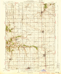
1939 Map of Wenona
USGS Topo · Published 1939About this map
The intersection of several major rail lines defines this late-1930s landscape across the Putnam, La Salle, and Marshall county borders. The Illinois Central and Alton railroads converge at Wenona, a hub of activity featuring the Wenona Cem. Further west, the town of Toluca serves as a significant junction point for the Atchison Topeka and Santa Fe. This area is notable for its exceptionally high density of rural schoolhouses, suggesting a well-populated agricultural region during this era.
Find a feature on this map
75 named features on this map. Tap any name to fly to it.
Don’t see what you’re looking for? This feature index may not catch every label — zoom into the map to look around manually.
Map Details
Editions of this 1939 Wenona Map
2 editions found
Other maps of this area

1892 · Ottawa
USGS Topo · 1:62,500

1893 · Lacon
USGS Topo · 1:62,500

1893 · Hennepin
USGS Topo · 1:62,500

1893 · Metamora
USGS Topo · 1:62,500

1893 · Lasalle
USGS Topo · 1:62,500

1909 · Hennepin
USGS Topo · 1:62,500

1911 · La Salle
USGS Topo · 1:62,500

1911 · Hennepin
USGS Topo · 1:62,500

1913 · La Salle
USGS Topo · 1:62,500

1915 · Ottawa
USGS Topo · 1:62,500