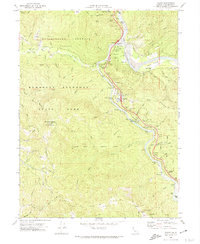
1969 Map of Weott
USGS Topo · Published 1974About this map
Humboldt Redwoods State Park dominates this landscape, preserving an incredible network of named groves along the Eel River and its South Fork. The map documents the region's dedication to conservation through specific endowments like the Garden Club of America Grove and the Rockefeller Redwood Forest. Settlement patterns are concentrated along the river corridor and the winding Avenue of the Giants, where the town of Weott and Myers Flat serve as primary hubs. Evidence of older history is found at the Dyerville and Camp Grant sites, reflecting shifts in population centers over time. Transportation is defined by the Northwestern Pacific railroad hugging the river banks, while the interior is accessible only by routes like Bull Creek Road and the Burlington Trail. Natural landmarks such as the Founders Tree and Grasshopper Mountain highlight the extreme elevation changes of this coastal range.
Find a feature on this map
86 named features on this map. Tap any name to fly to it.
Don’t see what you’re looking for? This feature index may not catch every label — zoom into the map to look around manually.
Map Details
Editions of this 1969 Weott Map
2 editions found
Other maps of this area

1919 · Glynn
USGS Topo · 1:62,500

1920 · Pt. Delagda
USGS Topo · 1:62,500

1921 · Dyerville
USGS Topo · 1:62,500

1921 · Briceland
USGS Topo · 1:62,500

1949 · Eureka
USGS Topo · 1:250,000

1949 · Point Delgada
USGS Topo · 1:62,500

1949 · Garberville
USGS Topo · 1:62,500

1949 · Weott
USGS Topo · 1:62,500

1950 · Scotia
USGS Topo · 1:62,500

1951 · Scotia
USGS Topo · 1:62,500