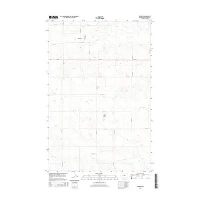
2014 Map of Werner
USGS Topo · Published 2014About this map
Werner sits at the northern edge of this high-plains landscape, situated along the corridor of Nd-200. The geography is defined by a series of drainage systems, with Spring Cr flowing across the northern section and Alkali Cr cutting through the central portion of the quadrangle. These watercourses have carved distinct coulees into the terrain, which rises sharply south of the settlement toward the prominent landmark of Horse Nose Butte. The map reflects a structured rural grid typical of western North Dakota, where a network of section-line roads like 95th Ave SW and 4th St SW provides access to the surrounding ranching and farming operations. This 2014 survey documents the enduring layout of the small community of Werner and its relationship to the topographical features of the Knife River watershed.
Find a feature on this map
12 named features on this map. Tap any name to fly to it.
Don’t see what you’re looking for? This feature index may not catch every label — zoom into the map to look around manually.
Map Details
Editions of this 2014 Werner Map
This is the sole edition of this map. No revisions or reprints were ever made.
Other maps of this area

1953 · Watford City
USGS Topo · 1:250,000

1957 · Watford City
USGS Topo · 1:250,000

1967 · Watford City
USGS Topo · 1:250,000

1970 · Halliday NE
USGS Topo · 1:24,000

1970 · Halliday NW
USGS Topo · 1:24,000

1970 · Dunn Center NE
USGS Topo · 1:24,000

1973 · Ziner Butte
USGS Topo · 1:24,000

1973 · Halliday
USGS Topo · 1:24,000

1973 · Dunn Center
USGS Topo · 1:24,000

1973 · Werner
USGS Topo · 1:24,000