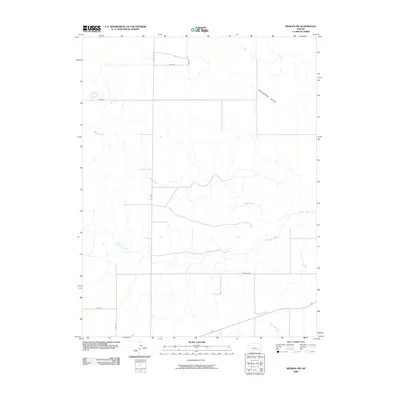
2009 Map of Weskan NW
USGS Topo · Published 2009About this map
The Smoky Hill River meanders across this High Plains landscape in Wallace County, defining a drainage system that includes several significant tributaries. To the north, the sharp incision of Rattlesnake Gulch cuts through the terrain, while Willow Creek and Eagleton Creek track through the central and southern portions of the quadrangle. This 2009 survey reflects the stark, open character of the region, where the primary human footprint is a strictly surveyed grid of section lines and rural routes. The map records a network of local roads including Wa Wu, Wa W-N, and RD Wa-W-O, which provide access across the wide intervals between watercourses in this sparsely settled corner of western Kansas.
Find a feature on this map
11 named features on this map. Tap any name to fly to it.
Don’t see what you’re looking for? This feature index may not catch every label — zoom into the map to look around manually.
Map Details
Editions of this 2009 Weskan NW Map
This is the sole edition of this map. No revisions or reprints were ever made.
Other maps of this area

1892 · Cheyenne Wells
USGS Topo · 1:125,000

1894 · Cheyenne Wells
USGS Topo · 1:125,000

1954 · Limon
USGS Topo · 1:250,000

1954 · Lamar
USGS Topo · 1:250,000

1954 · Goodland
USGS Topo · 1:250,000

1955 · Scott City
USGS Topo · 1:250,000

1956 · Goodland
USGS Topo · 1:250,000

1957 · Limon
USGS Topo · 1:250,000

1957 · Goodland
USGS Topo · 1:250,000

1958 · Limon
USGS Topo · 1:250,000