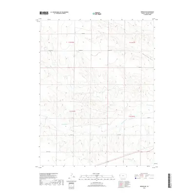
2018 Map of Weskan NW
USGS Topo · Published 2018About this map
The Smoky Hill River winds through the central portion of this High Plains landscape in Wallace County, providing a critical water source in a region defined by its drainage systems. To the north, Willow Cr and the descriptively named Rattle Snake Gulch carve the terrain, while Eagletail Cr cuts across the southern section. This 2018 survey reveals a sparse human footprint dominated by a systematic grid of section roads, many bearing evocative local names like Nighthawk Rd, Tumbleweed Rd, and Outpost Rd. These paths reflect the modern agricultural and ranching infrastructure of Weskan Township, where large-scale land management is organized across the townships of t12s r42w, t12s r41w, and their neighbors. The map serves as a detailed record of contemporary rural Kansas, capturing the intersection of natural river valleys and the rigid geometry of the Public Land Survey System.
Find a feature on this map
17 named features on this map. Tap any name to fly to it.
Don’t see what you’re looking for? This feature index may not catch every label — zoom into the map to look around manually.
Map Details
Editions of this 2018 Weskan NW Map
This is the sole edition of this map. No revisions or reprints were ever made.
Other maps of this area

1892 · Cheyenne Wells
USGS Topo · 1:125,000

1894 · Cheyenne Wells
USGS Topo · 1:125,000

1954 · Limon
USGS Topo · 1:250,000

1954 · Lamar
USGS Topo · 1:250,000

1954 · Goodland
USGS Topo · 1:250,000

1955 · Scott City
USGS Topo · 1:250,000

1956 · Goodland
USGS Topo · 1:250,000

1957 · Limon
USGS Topo · 1:250,000

1957 · Goodland
USGS Topo · 1:250,000

1958 · Limon
USGS Topo · 1:250,000