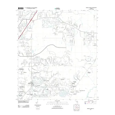
2012 Map of Wesley Chapel
USGS Topo · Published 2012About this map
Heritage Isles and Cory Lake Isles characterize the sprawling residential development in northern Hillsborough County at the dawn of the twenty-first century. This landscape is defined by its complex water management and master-planned communities, where dense residential pockets like Pebble Creek Village and Live Oak Preserve are woven between the riparian corridors of the New River and Basset Br. The southern portion of the map showcases significant preservation efforts and extensive golf facilities, including the Highwoods Preserve and the Heritage Isles Golf Course. Transportation and infrastructure are centered around the Tampa North Aero Park and key retail hubs such as the Shoppes at Cross Creek. This 2012 survey documents a period of rapid suburban maturation, where established settlements like Branchton are integrated into a modern network of winding drives and local waterways, including the Hillsborough River.
Find a feature on this map
185 named features on this map. Tap any name to fly to it.
Don’t see what you’re looking for? This feature index may not catch every label — zoom into the map to look around manually.
Map Details
Editions of this 2012 Wesley Chapel Map
This is the sole edition of this map. No revisions or reprints were ever made.
Other maps of this area

1943 · Thonotosassa
USGS Topo · 1:24,000

1943 · Lutz
USGS Topo · 1:24,000

1944 · Sulphur Springs
USGS Topo · 1:31,680

1944 · Wesley Chapel
USGS Topo · 1:31,680

1944 · Lutz
USGS Topo · 1:31,680

1944 · Thonotosassa
USGS Topo · 1:31,680

1944 · Antioch
USGS Topo · 1:31,680

1945 · Sulphur Springs
USGS Topo · 1:31,680

1947 · Zephyrhills
USGS Topo · 1:24,000
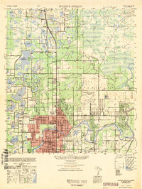
1949 · Sulphur Springs
USGS Topo · 1:25,000
Featured Places
- Tampa, FL
- Pebble Creek, FL
- Club Manor East of Grand Hampton, Tampa
- Trout Creek Commons, Tampa
- Branchton, FL