Loading...
Loading map...2024 Map of Wesley Chapel
USGS Topo · Published 2024About this map
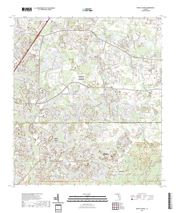
Wesley Chapel sits at the heart of this contemporary landscape, illustrating the rapid suburban expansion north of Tampa along the Pasco Co Hillsborough Co line. The map highlights a complex network of residential developments and academic institutions, most notably the Pasco - Hernando State College Porter Campus near State Road 56.
Find a feature on this map
25 named features on this map. Tap any name to fly to it.
Don’t see what you’re looking for? This feature index may not catch every label — zoom into the map to look around manually.
Map Details
Date Portrayed2024
Date Published2024
PublisherU.S. Geological Survey
Map TypeTopographic
Scale1:24000
Physical Dimensions24 x 29 inches
Editions of this 2024 Wesley Chapel Map
This is the sole edition of this map. No revisions or reprints were ever made.
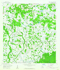
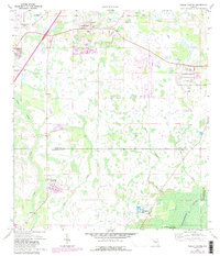
Historical Maps of Trout Creek Commons Through Time
3 maps found
Featured Locations
- Branchton, FL
- Pebble Creek, FL
- Tampa, FL
- Club Manor East of Grand Hampton, Tampa
- Trout Creek Commons, Tampa
Source Details
SourceU.S. Geological Survey
CopyrightPublic Domain