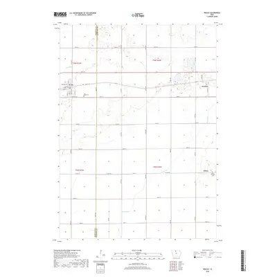
2018 Map of Wesley
USGS Topo · Published 2018About this map
The town of Wesley serves as the focal point of this northern Iowa landscape, situated along the border of Kossuth and Hancock counties. The terrain is defined by its agricultural grid and a complex hydrological system, where the Boone River meanders through the eastern sections near Stilson. Significant local landmarks include Saint Joseph Cem south of Wesley and the Boone Township Cem further southeast, providing valuable points of interest for genealogical research. The map illustrates the evolution of regional transport, showing the path of Old Hwy 18 and a network of county roads like Co Rd R16 and Co Hwy B46 that link smaller communities such as Hutchins. The integration of natural waterways like Prairie Cr with man-made improvements, specifically Drainage Ditch Number 10, highlights the 21st-century management of this productive prairie land.
Find a feature on this map
45 named features on this map. Tap any name to fly to it.
Don’t see what you’re looking for? This feature index may not catch every label — zoom into the map to look around manually.
Map Details
Editions of this 2018 Wesley Map
This is the sole edition of this map. No revisions or reprints were ever made.
Other maps of this area

1954 · Fairmont
USGS Topo · 1:250,000

1954 · Mason City
USGS Topo · 1:250,000

1954 · Waterloo
USGS Topo · 1:250,000

1954 · Fort Dodge
USGS Topo · 1:250,000

1955 · Waterloo
USGS Topo · 1:250,000

1957 · Fort Dodge
USGS Topo · 1:250,000

1957 · Mason City
USGS Topo · 1:250,000

1958 · Mason City
USGS Topo · 1:250,000

1958 · Fort Dodge
USGS Topo · 1:250,000

1958 · Fairmont
USGS Topo · 1:250,000