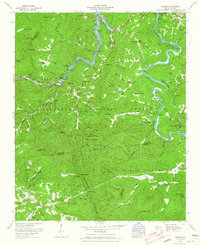
1961 Map of Wesser
USGS Topo · Published 1965About this map
Fontana Lake dominates the northern landscape of this region, where the Little Tennessee River and Nantahala River converge amidst the dense reaches of the Nantahala National Forest. The 1961 survey, published by the U.S. Geological Survey and Tennessee Valley Authority, captures the area during a period of established hydroelectric management, showing the intricate shoreline and mile markers along the water. The rugged topography is defined by the steep Nantahala Gorge, where the Southern railroad line follows the river's bend. Small settlements like Almond, Needmore, and Lauada serve as primary points of interest for local history, while remote landmarks such as Tellico Church and the Maple Springs Cem provide valuable data for genealogical research. The map also delineates the high ridges of the Stecoah Mountains and prominent peaks like Wesser Bald.
Find a feature on this map
84 named features on this map. Tap any name to fly to it.
Don’t see what you’re looking for? This feature index may not catch every label — zoom into the map to look around manually.
Map Details
Editions of this 1961 Wesser Map
4 editions found
Other maps of this area

1891 · Cowee
USGS Topo · 1:125,000

1897 · Cowee
USGS Topo · 1:125,000

1907 · Cowee
USGS Topo · 1:125,000

1933 · Bryson
USGS Topo · 1:62,500

1933 · Bushnell
USGS Topo · 1:62,500

1935 · Franklin
USGS Topo · 1:24,000

1935 · Burningtown Bald
USGS Topo · 1:24,000

1935 · Topton
USGS Topo · 1:24,000

1935 · Wayah Bald
USGS Topo · 1:48,000

1936 · Proctor
USGS Topo · 1:24,000