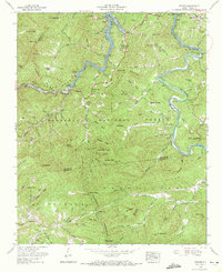
1961 Map of Wesser
USGS Topo · Published 1972About this map
Nantahala National Forest dominates this topographic survey, which captures the dramatic confluence of river and rail during the early 1960s. The Southern railroad follows the winding path of the Nantahala River through the narrow Nantahala Gorge, passing through mountain communities like Wesser and Almond. The landscape is defined by the backwaters of Fontana Lake and the Little Tennessee River, which carve deep valleys between high points such as Wesser Bald and De Hart Bald. Evidence of early Appalachian settlement is preserved in the numerous family-named landmarks and remote places of worship, including Silver Creek Church and Nantahala Ch. Genealogists may find value in the specific locations of upland cemeteries like Windy Gap Cem and Brentwood Cem, while the Appalachian Trail is shown tracing the high ridges along the Swain and Graham county lines.
Find a feature on this map
101 named features on this map. Tap any name to fly to it.
Don’t see what you’re looking for? This feature index may not catch every label — zoom into the map to look around manually.
Map Details
Editions of this 1961 Wesser Map
4 editions found
Other maps of this area

1891 · Cowee
USGS Topo · 1:125,000

1897 · Cowee
USGS Topo · 1:125,000

1907 · Cowee
USGS Topo · 1:125,000

1933 · Bryson
USGS Topo · 1:62,500

1933 · Bushnell
USGS Topo · 1:62,500

1935 · Franklin
USGS Topo · 1:24,000

1935 · Burningtown Bald
USGS Topo · 1:24,000

1935 · Topton
USGS Topo · 1:24,000

1935 · Wayah Bald
USGS Topo · 1:48,000

1936 · Proctor
USGS Topo · 1:24,000