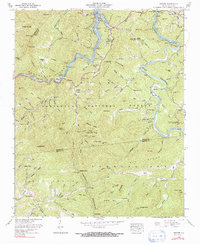
1961 Map of Wesser
USGS Topo · Published 1991About this map
The Nantahala Gorge defines the heart of this landscape, where the Southern railroad and river wind through a narrow corridor toward the sprawling waters of Fontana Lake. This 1961 revision documents the mountain terrain as it appeared following the mid-century hydroelectric developments that transformed the Little Tennessee River. Settlement is concentrated in small pockets like Almond and Wesser, with institutional life centered around sites such as Almond Sch and Nantahala Ch.
Find a feature on this map
139 named features on this map. Tap any name to fly to it.
Don’t see what you’re looking for? This feature index may not catch every label — zoom into the map to look around manually.
Map Details
Editions of this 1961 Wesser Map
4 editions found
Other maps of this area

1891 · Cowee
USGS Topo · 1:125,000

1897 · Cowee
USGS Topo · 1:125,000

1907 · Cowee
USGS Topo · 1:125,000

1933 · Bryson
USGS Topo · 1:62,500

1933 · Bushnell
USGS Topo · 1:62,500

1935 · Franklin
USGS Topo · 1:24,000

1935 · Burningtown Bald
USGS Topo · 1:24,000

1935 · Topton
USGS Topo · 1:24,000

1935 · Wayah Bald
USGS Topo · 1:48,000

1936 · Proctor
USGS Topo · 1:24,000