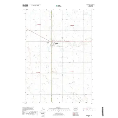
2017 Map of Wessington
USGS Topo · Published 2017About this map
Wessington serves as the primary hub of activity on this prairie landscape, situated exactly along the boundary of Hand and Beadle Counties. This modern survey reveals a highly organized township system, where a dense grid of numbered roads like 200th St and 375th Ave facilitates access to the surrounding agricultural land. The town's historical roots are anchored by sacred spaces, notably the Saint Josephs Catholic Cem and Wessington Cem located just west of the main settlement. Three major drainage systems, Cain Cr, Silver Cr, and Pearl Cr, meander through the sections, providing essential natural drainage for the vast Dakota plains. The map illustrates how transportation corridors, including Barden St W, have historically shaped the growth of this rural community at the intersection of local county roads.
Find a feature on this map
29 named features on this map. Tap any name to fly to it.
Don’t see what you’re looking for? This feature index may not catch every label — zoom into the map to look around manually.
Map Details
Editions of this 2017 Wessington Map
This is the sole edition of this map. No revisions or reprints were ever made.
Other maps of this area

1899 · Redfield
USGS Topo · 1:125,000

1949 · Vayland SE
USGS Topo · 1:24,000

1950 · Vayland
USGS Topo · 1:24,000

1950 · Wessington
USGS Topo · 1:24,000

1950 · Wessington NE
USGS Topo · 1:24,000

1951 · Wessington SE
USGS Topo · 1:24,000

1951 · Wessington SW
USGS Topo · 1:24,000

1951 · Vayland SE
USGS Topo · 1:24,000

1953 · Huron
USGS Topo · 1:250,000

1954 · Huron
USGS Topo · 1:250,000