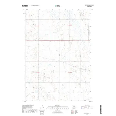
2017 Map of Wessington NE
USGS Topo · Published 2017About this map
Cain Creek meanders through the heart of this Beadle County landscape, defining a terrain shaped by the complex hydrology of the Glacial Lake Agassiz region. In this contemporary snapshot of South Dakota's prairie, the land is partitioned into a rigid section-line grid of rural roads such as 200th St and Co Rd 18, reflecting the enduring influence of the Public Land Survey System. The hydrography is particularly distinctive, featuring seasonal wetlands and depressions including Bracken Slough and Norwegian Slough. These features, alongside the intermittent flow of Cain Cr, illustrate the drainage patterns essential to the local agricultural economy. This map serves as a precise record of the intersection between modern infrastructure and the natural sloughs that have characterized this portion of the James River Valley for generations.
Find a feature on this map
15 named features on this map. Tap any name to fly to it.
Don’t see what you’re looking for? This feature index may not catch every label — zoom into the map to look around manually.
Map Details
Editions of this 2017 Wessington NE Map
This is the sole edition of this map. No revisions or reprints were ever made.
Other maps of this area

1895 · Byron
USGS Topo · 1:125,000

1898 · Huron
USGS Topo · 1:125,000

1899 · Redfield
USGS Topo · 1:125,000

1950 · Wessington
USGS Topo · 1:24,000

1950 · Wessington NE
USGS Topo · 1:24,000

1951 · Wessington SE
USGS Topo · 1:24,000

1951 · Wessington SW
USGS Topo · 1:24,000

1953 · Huron
USGS Topo · 1:250,000

1954 · Huron
USGS Topo · 1:250,000

1967 · Hitchcock SW
USGS Topo · 1:24,000