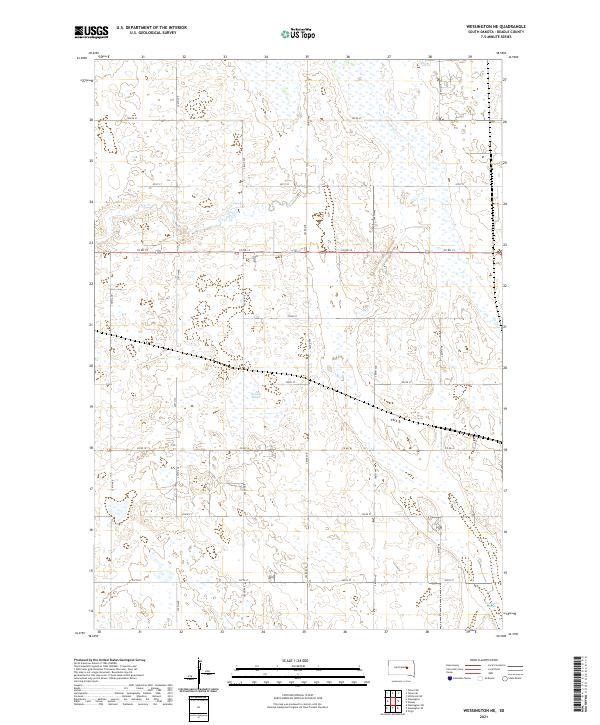
2021 Map of Wessington NE
USGS Topo · Published 2021About this map
Cain Creek and its tributary Cain Cr wind through this Beadle County landscape, defining the hydrology of a region characterized by significant prairie wetlands. The presence of Bracken Slough in the central portion and Norwegian Slough in the southeast corner indicates the glaciated terrain's natural drainage patterns. This section of South Dakota is partitioned by a strict section-line road grid, including Co Rd 14 and Co Rd 18, which facilitate movement across the agricultural townships of T112N R65W and T111N R64W. The survey highlights the intersection of natural water systems and human-imposed boundaries, where seasonal sloughs and creek beds often dictate the placement of farm infrastructure and local thoroughfares such as 382nd Ave and 207th St.
Find a feature on this map
22 named features on this map. Tap any name to fly to it.
Don’t see what you’re looking for? This feature index may not catch every label — zoom into the map to look around manually.
Map Details
Editions of this 2021 Wessington NE Map
This is the sole edition of this map. No revisions or reprints were ever made.
Other maps of this area

1895 · Byron
USGS Topo · 1:125,000

1898 · Huron
USGS Topo · 1:125,000

1899 · Redfield
USGS Topo · 1:125,000

1950 · Wessington
USGS Topo · 1:24,000

1950 · Wessington NE
USGS Topo · 1:24,000

1951 · Wessington SE
USGS Topo · 1:24,000

1951 · Wessington SW
USGS Topo · 1:24,000

1953 · Huron
USGS Topo · 1:250,000

1954 · Huron
USGS Topo · 1:250,000

1967 · Hitchcock SW
USGS Topo · 1:24,000