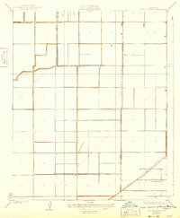
1929 Map of West Alpaugh
USGS Topo · Published 1943About this map
The boundary between Kings Co Tulare Co bisects a grid of agricultural development and irrigation infrastructure in this central California landscape. The terrain is characterized by large-scale water management, evidenced by the prominent Tulare Lake Water Company Canal and the Homeland Canal, which reflect the region's transformation for industrial-scale farming. In the northwestern corner, Kings Lake sits adjacent to the Shore R. R., a rail line that once hugged the shifting margins of the Tulare Lake basin. The map captures a period when the settlement of West Alpaugh served as a local hub amidst the section lines, providing a clear view of the land division and hydraulic engineering required to sustain the valley's agrarian economy.
Find a feature on this map
6 named features on this map. Tap any name to fly to it.
Don’t see what you’re looking for? This feature index may not catch every label — zoom into the map to look around manually.
Map Details
Editions of this 1929 West Alpaugh Map
2 editions found
Other maps of this area

1914 · Lost Hills
USGS Topo · 1:125,000

1927 · Lake View School
USGS Topo · 1:31,680

1928 · Corcoran
USGS Topo · 1:31,680

1929 · Alpaugh
USGS Topo · 1:31,680

1929 · Hacienda Ranch
USGS Topo · 1:31,680

1929 · West Alpaugh
USGS Topo · 1:31,680

1929 · Allensworth
USGS Topo · 1:31,680

1931 · Harvester
USGS Topo · 1:31,680

1932 · El Rico Ranch
USGS Topo · 1:31,680

1932 · Lone Tree Well
USGS Topo · 1:31,680