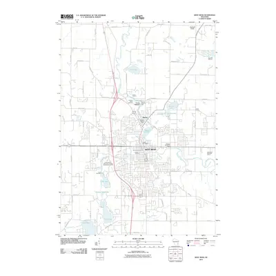
2010 Map of West Bend
USGS Topo · Published 2010About this map
The Milwaukee River winds through the heart of West Bend, serving as the central axis for a landscape defined by its glacial heritage and industrial foundations. The map reveals the dense network of water management features along the river, including the Young America Dam near the settlement of Young America and the Woolen Mill WP95 Dam further downstream. These sites, along with Barton Pond 219, reflect a history of river-powered industry that shaped the early growth of the region.
Find a feature on this map
70 named features on this map. Tap any name to fly to it.
Don’t see what you’re looking for? This feature index may not catch every label — zoom into the map to look around manually.
Map Details
Editions of this 2010 West Bend Map
This is the sole edition of this map. No revisions or reprints were ever made.
Other maps of this area

1904 · West Bend
USGS Topo · 1:62,500

1904 · Hartford
USGS Topo · 1:62,500

1955 · Campbellsport
USGS Topo · 1:62,500

1955 · Kewaskum
USGS Topo · 1:62,500

1957 · Madison
USGS Topo · 1:250,000

1959 · West Bend
USGS Topo · 1:62,500

1959 · Hartford
USGS Topo · 1:62,500

1959 · Allenton
USGS Topo · 1:24,000
1959 · Newburg
USGS Topo · 1:24,000
1959 · Jackson
USGS Topo · 1:24,000