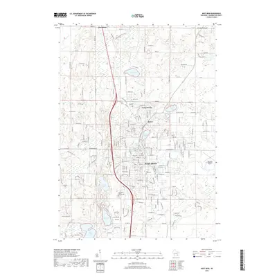
2018 Map of West Bend
USGS Topo · Published 2018About this map
The Milwaukee River winds through this detailed survey of Washington County, anchoring a landscape shaped by glacial activity in the Kettle Moraine. The city of West Bend serves as the central hub, surrounded by smaller historical settlements such as Barton and Young America. This area is characterized by a high concentration of natural water bodies, including Wallace Lake, Silver Lake, and Barton Pond, which reflect the region's post-glacial topography. Local history is well-preserved through numerous burial sites like Old Saint Marys Cem and Holy Angels Cem. The layout of the road network, including the modern paths of Co HWY NN and Paradise DR, shows the transition from the core urban center to the outlying residential and agricultural zones. Nearby, Washington County Memorial Park and the West Bend Municipal Airport provide significant local landmarks that highlight the community's mid-to-late 20th-century development and recreation patterns.
Find a feature on this map
59 named features on this map. Tap any name to fly to it.
Don’t see what you’re looking for? This feature index may not catch every label — zoom into the map to look around manually.
Map Details
Editions of this 2018 West Bend Map
This is the sole edition of this map. No revisions or reprints were ever made.
Other maps of this area

1904 · West Bend
USGS Topo · 1:62,500

1904 · Hartford
USGS Topo · 1:62,500

1955 · Campbellsport
USGS Topo · 1:62,500

1955 · Kewaskum
USGS Topo · 1:62,500

1957 · Madison
USGS Topo · 1:250,000

1959 · West Bend
USGS Topo · 1:62,500

1959 · Hartford
USGS Topo · 1:62,500

1959 · Allenton
USGS Topo · 1:24,000
1959 · Newburg
USGS Topo · 1:24,000
1959 · Jackson
USGS Topo · 1:24,000