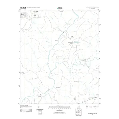
2011 Map of West Blocton East
USGS Topo · Published 2011About this map
Italian Town and the neighboring settlements of Smith Hill and West Blocton anchor the northwestern portion of this Bibb County landscape. The area is defined by the winding course of the Cahaba River, which transitions through numerous named crossings including Pine Island Ford, Light Ford, and Blake Ford. This 2011 survey documents a mix of industrial remnants and established rural communities, highlighted by the Kimberly Clark Paper Company Lake and its associated dam.
Find a feature on this map
63 named features on this map. Tap any name to fly to it.
Don’t see what you’re looking for? This feature index may not catch every label — zoom into the map to look around manually.
Map Details
Editions of this 2011 West Blocton East Map
This is the sole edition of this map. No revisions or reprints were ever made.
Other maps of this area

1890 · Bessemer
USGS Topo · 1:125,000

1891 · Clanton
USGS Topo · 1:125,000

1892 · Bessemer
USGS Topo · 1:125,000

1899 · Brookwood
USGS Topo · 1:125,000

1910 · Montevallo
USGS Topo · 1:62,500

1934 · Blocton
USGS Topo · 1:48,000

1940 · Blocton
USGS Topo · 1:62,500

1953 · Montgomery
USGS Topo · 1:250,000

1953 · Birmingham
USGS Topo · 1:250,000

1956 · Birmingham
USGS Topo · 1:250,000