2024 Map of West Burke
USGS Topo · Published 2024About this map
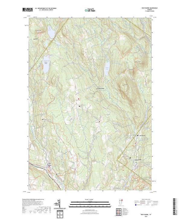
The confluence of the West Branch Passumpsic River and Sutton River anchors the settlement of West Burke in this detailed view of Vermont's northern highlands. The landscape is defined by the high ridges of McSherry Mtn and Packer Mtn, with numerous small ponds such as Newark Pond and Center Pond tucked between the peaks. Local history is well-preserved through family-named landmarks and several burying grounds including Hillside Cem and Packer Cem. The map reveals a dispersed settlement pattern centered on rural crossroads like Newark Hollow and Hartwellville, connected by a network of winding roads such as Bald Hill Pond Rd and Schoolhouse Rd. The topography illustrates the drainage basins feeding the East Branch Passumpsic River, providing a clear record of the area's contemporary geography and rural land use.
Find a feature on this map
84 named features on this map. Tap any name to fly to it.
Don’t see what you’re looking for? This feature index may not catch every label — zoom into the map to look around manually.
Map Details
Editions of this 2024 West Burke Map
This is the sole edition of this map. No revisions or reprints were ever made.