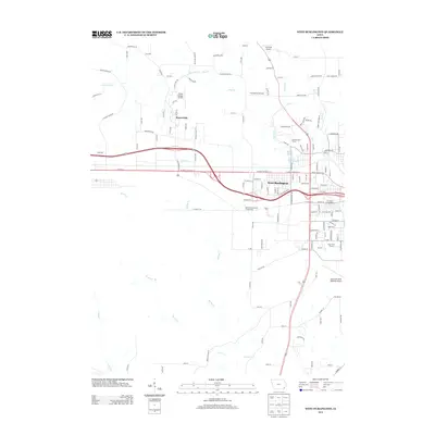
2013 Map of West Burlington
USGS Topo · Published 2013About this map
West Burlington serves as a focal point of this 2013 survey, showing the intensive infrastructure and recreational development west of the Mississippi River. The landscape is defined by the drainage networks of Flint Cr and Brush Cr, which have shaped the local road patterns and settlement boundaries. Notable for its concentration of public venues and specialized transportation hubs, the map documents both the Des Moines County Fairgrounds and the Tri-State Fairgrounds, alongside several aviation sites including the Southeast Iowa Regional Airport and the smaller Diewold Airport. The presence of the Ancam Antique Airfield north of Beaverdale highlights a unique local niche in aviation history. For genealogists and local historians, the map details the suburban and rural interface, tracing residential growth around landmarks like Izaak Walton Lake and the Flint Bottom Raceway.
Find a feature on this map
131 named features on this map. Tap any name to fly to it.
Don’t see what you’re looking for? This feature index may not catch every label — zoom into the map to look around manually.
Map Details
Editions of this 2013 West Burlington Map
This is the sole edition of this map. No revisions or reprints were ever made.
Other maps of this area

1932 · Lomax
USGS Topo · 1:62,500

1934 · Burlington
USGS Topo · 1:48,000

1936 · Fort Madison
USGS Topo · 1:62,500

1937 · Lomax
USGS Topo · 1:62,500

1940 · Burlington
USGS Topo · 1:62,500

1958 · Burlington
USGS Topo · 1:250,000

1961 · Burlington
USGS Topo · 1:250,000

1963 · Burlington
USGS Topo · 1:250,000
1964 · Burlington
USGS Topo · 1:24,000

1964 · Lomax
USGS Topo · 1:24,000