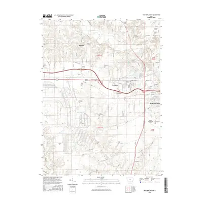
2015 Map of West Burlington
USGS Topo · Published 2015About this map
The rolling hills of Des Moines County are densely populated with family burial plots and township cemeteries in this study of Burlington and West Burlington. Genealogists will find a high concentration of small, often private sites including the Steingreaber Family Plot, Carter Burial Plot, and Wykerts Cem, alongside larger grounds like the Burlington Jewish Cem and Saint Mary's Cem. The landscape is defined by the winding paths of Flint Cr, Little Flint Cr, and Spring Cr, which cut through the terrain north and west of the city centers. While the suburban expansion of Burlington is evident, pockets of local heritage remain preserved, such as the Old County Home Cem and the Ancam Antique Airfield near Beaverdale. The map illustrates the 2015 layout of industrial corridors and residential developments, showing how the modern city has grown around these older landmarks and waterways.
Find a feature on this map
139 named features on this map. Tap any name to fly to it.
Don’t see what you’re looking for? This feature index may not catch every label — zoom into the map to look around manually.
Map Details
Editions of this 2015 West Burlington Map
This is the sole edition of this map. No revisions or reprints were ever made.
Other maps of this area

1932 · Lomax
USGS Topo · 1:62,500

1934 · Burlington
USGS Topo · 1:48,000

1936 · Fort Madison
USGS Topo · 1:62,500

1937 · Lomax
USGS Topo · 1:62,500

1940 · Burlington
USGS Topo · 1:62,500

1958 · Burlington
USGS Topo · 1:250,000

1961 · Burlington
USGS Topo · 1:250,000

1963 · Burlington
USGS Topo · 1:250,000
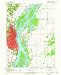
1964 · Burlington
USGS Topo · 1:24,000

1964 · Lomax
USGS Topo · 1:24,000