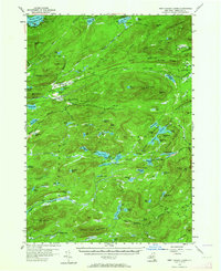
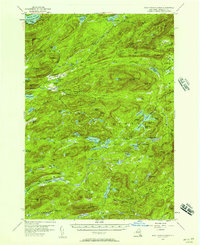
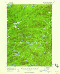
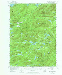
1954 Map of West Canada Lakes
USGS Topo · Published 1964About this map
The Northville Lake Placid Trail winds through this high Adirondack wilderness, connecting remote backcountry landmarks during the mid-1950s. The landscape is defined by its complex hydrology, where the Fulton Chain Lakes and Seventh Lake in the northwest give way to the intricate headwaters of West Canada Creek. Human presence is sparse and specialized, marked by the lonely outpost of Kenwells, several Shelter points, and a Rangers Camp near West Lake. High-elevation observation is noted at the Lookout Tower atop Wakely Mountain and another on Pillsbury Mtn. Significant wetland features like Sampson Bog and the Sumner Plains reflect the natural drainage patterns of this interior mountain region, while established sites like Millers Camp indicate the era's ongoing usage for forest management and recreation within the state park.
Find a feature on this map
110 named features on this map. Tap any name to fly to it.
Don’t see what you’re looking for? This feature index may not catch every label — zoom into the map to look around manually.
Map Details
Editions of this 1954 West Canada Lakes Map
4 editions found
Other maps of this area

1899 · Indian Lake
USGS Topo · 1:62,500

1900 · Canada Lake
USGS Topo · 1:62,500

1900 · Wilmurt
USGS Topo · 1:62,500

1901 · Old Forge
USGS Topo · 1:62,500

1902 · Wilmurt
USGS Topo · 1:62,500

1902 · Indian Lake
USGS Topo · 1:62,500

1903 · Big Moose
USGS Topo · 1:62,500

1903 · West Canada Lakes
USGS Topo · 1:62,500

1903 · Raquette Lake
USGS Topo · 1:62,500

1903 · Blue Mountain
USGS Topo · 1:62,500