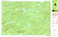
1990 Map of West Canada Lakes
USGS Topo · Published 1990About this map
Adirondack Park's high-country wilderness is documented here through a dense network of water features and relief in the townships of Morehouse and Arietta. The drainage of the West Canada Creek and the Indian River defines the landscape, with remote outposts like Millers Camp providing rare evidence of human habitation amidst the rugged terrain. Notable water bodies such as Cedar Lakes, West Lake, and Brooktrout Lake are mapped alongside significant elevations like Spruce Lake Mountain and Goodluck Mtn. This 1990 provisional edition, compiled from 1983 aerial photography, reveals the complex hydrography of the region before modern digital updates, including small, named features like the Puddle Hole and Sampson Bog. The map captures the preserve as it appeared in the late twentieth century, highlighting the intricate transition between marshes and mountains in Hamilton County.
Find a feature on this map
56 named features on this map. Tap any name to fly to it.
Don’t see what you’re looking for? This feature index may not catch every label — zoom into the map to look around manually.
Map Details
Editions of this 1990 West Canada Lakes Map
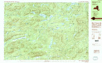
2 editions found
Other maps of this area

1899 · Indian Lake
USGS Topo · 1:62,500

1900 · Canada Lake
USGS Topo · 1:62,500

1900 · Wilmurt
USGS Topo · 1:62,500

1901 · Old Forge
USGS Topo · 1:62,500

1902 · Wilmurt
USGS Topo · 1:62,500

1902 · Indian Lake
USGS Topo · 1:62,500

1903 · West Canada Lakes
USGS Topo · 1:62,500

1904 · Piseco Lake
USGS Topo · 1:62,500

1906 · Piseco Lake
USGS Topo · 1:62,500

1907 · Lake Pleasant
USGS Topo · 1:62,500