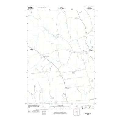
2010 Map of West Chazy
USGS Topo · Published 2010About this map
West Chazy and West Beekmantown anchor this rural landscape in Clinton County, where the Little Chazy River flows past the base of Cobblestone Hill. The map documents a community defined by its watercourses and family legacies, evidenced by a high density of burial grounds including the West Chazy Rural Cemetery, Saint Josephs Cemetery, and the Robinson District Cemetery. The terrain transitions from the low-lying basin of the Dead Sea in the northwest to the prominence of Rand Hill in the southwest, creating a diverse topography for local land use.
Find a feature on this map
54 named features on this map. Tap any name to fly to it.
Don’t see what you’re looking for? This feature index may not catch every label — zoom into the map to look around manually.
Map Details
Editions of this 2010 West Chazy Map
This is the sole edition of this map. No revisions or reprints were ever made.
Other maps of this area

1894 · Plattsburg
USGS Topo · 1:62,500

1895 · Mooers
USGS Topo · 1:62,500

1895 · Rouse Point
USGS Topo · 1:62,500

1899 · Mooers
USGS Topo · 1:62,500

1906 · Plattsburg
USGS Topo · 1:62,500

1907 · Rouse Point
USGS Topo · 1:62,500

1913 · Dannemora
USGS Topo · 1:62,500

1939 · Rouses Point
USGS Topo · 1:62,500

1939 · Plattsburg
USGS Topo · 1:62,500

1941 · Plattsburg
USGS Topo · 1:62,500