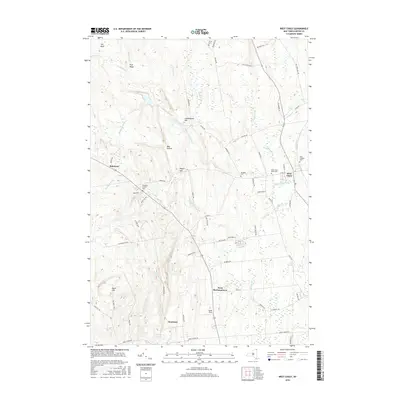
2016 Map of West Chazy
USGS Topo · Published 2016About this map
West Chazy and West Beekmantown anchor this rural landscape in the northeastern corner of the state, where the terrain shifts from the lowlands of the Little Chazy River toward the rising elevations of Rand Hill. The area is defined by a series of north-south ridges and brooks, including Tracy Brook and Rea Brook, which have historically influenced the placement of farms and roads. Genealogists will find several burial grounds across the township, such as the West Chazy Rural Cem and the Saint Josephs Cem, alongside older family markers like the Stone Cem. The map reveals the persistence of early settlement names like Robinson and Beartown, positioned near landmarks like Cobblestone Hill and Bear Hollow. The detailed drainage network, featuring Dead Sea and Duncan Pond, highlights the complex hydrology that supported this region's agriculture and early homesteads.
Find a feature on this map
67 named features on this map. Tap any name to fly to it.
Don’t see what you’re looking for? This feature index may not catch every label — zoom into the map to look around manually.
Map Details
Editions of this 2016 West Chazy Map
This is the sole edition of this map. No revisions or reprints were ever made.
Other maps of this area

1894 · Plattsburg
USGS Topo · 1:62,500

1895 · Mooers
USGS Topo · 1:62,500

1895 · Rouse Point
USGS Topo · 1:62,500

1899 · Mooers
USGS Topo · 1:62,500

1906 · Plattsburg
USGS Topo · 1:62,500

1907 · Rouse Point
USGS Topo · 1:62,500

1913 · Dannemora
USGS Topo · 1:62,500

1939 · Rouses Point
USGS Topo · 1:62,500

1939 · Plattsburg
USGS Topo · 1:62,500

1941 · Plattsburg
USGS Topo · 1:62,500