
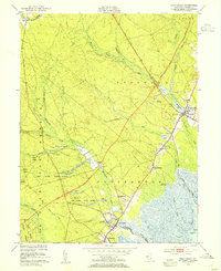
1951 Map of West Creek
USGS Topo · Published 1951About this map
Cranberry Bogs dot the lowlands of Ocean County in this mid-century survey, illustrating the specialized agricultural landscape along the New Jersey shore. The intersection of local industry and modern transportation is evident as the Garden State Parkway cuts through the State Forest and near settlements like Stafford Forge and Staffordville. In the southern portion of the quadrangle, the community of West Creek is situated near the winding Westecunk Creek, while the northern area is anchored by the village of Manahawkin and its namesake Manahawkin Lake. Along the coast, the Staffordville Public Landing provides access to Channel Cove, reflecting the enduring maritime character of the region. Local landmarks such as the Township Sch and Cedar Run Cem provide specific points of interest for genealogists tracing family roots in Eagleswood and Stafford townships.
Find a feature on this map
38 named features on this map. Tap any name to fly to it.
Don’t see what you’re looking for? This feature index may not catch every label — zoom into the map to look around manually.
Map Details
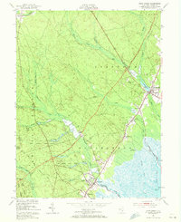
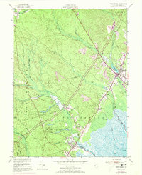
Editions of this 1951 West Creek Map
5 editions found

Other maps of this area

1884 · Whitings
USGS Topo · 1:62,500

1888 · Barnegat
USGS Topo · 1:62,500

1888 · Little Egg Harbor
USGS Topo · 1:62,500

1888 · Long Beach
USGS Topo · 1:62,500

1888 · Whitings
USGS Topo · 1:62,500

1893 · Little Egg Harbor
USGS Topo · 1:62,500

1893 · Long Beach
USGS Topo · 1:62,500

1893 · Barnegat
USGS Topo · 1:62,500

1898 · Barnegat
USGS Topo · 1:62,500

1919 · Long Beach
USGS Topo · 1:62,500
Featured Places
- Stafford Township, NJ
- Barnegat Township, NJ
- Little Egg Harbor Township, NJ
- Eagleswood Township, NJ
- Staffordville, Eagleswood Township